by CONNIE TABBERT
Editor
WHITEWATER REGION — Road closures are forcing area residents, as well as emergency vehicles, to rethink how they are going to get where they are going.
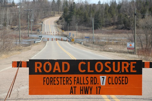
Foresters Falls Road remains closed between Highway 17 and Mansel Hill Road. As of Wednesday at noon, there were no other road closures in Whitewater Region township according to www.municipal511.ca
However, weight restrictions are in place on many roads.
Whitewater Region fire chief Jonathan Wilker, who is also manager of emergency services, said Tuesday afternoon Muskrat Lake is being watched carefully.
“It seems to have levelled off, but we’re hoping that the rain holds off today and it stays at the level it is now,” he said.
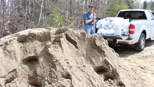
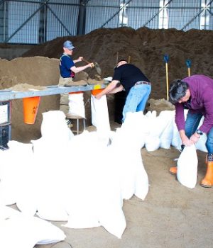
Active sandbagging by volunteers, including firefighters, is happening, he said.

There were several people helping out on the Easter weekend, however, with people returning to work, there weren’t many available during the weekday.
However, he expected there would be plenty of help in the evenings.
The water level on the Ottawa River is supposed to come up this week, so more sandbags will be filled as the week goes on, Chief Wilker said.
There are sand bag sites around the municipality: Greenway Drive; La Passe dock; Edgewater Trail; Sand Point Trail; Sunset Trail; Bird Lake Trail; Vizena Trail; Waterview Road; the Ross Sand Dome and Westmeath Garage.
At the Westmeath Garage there are sandbags already filled that residents can pick up, he noted.
“We’re going to try and keep ahead with the sand bags as much as we can during the evening,” Chief Wilker said.
He said the township has about 15,000 sandbags, however, the County has more if they are needed.
Chief Wilker said there were no 911 calls over the weekend.
He stressed, “If anyone is in an emergency situation, don’t hesitate to call and we’ll respond.”
Tuesday morning Jeannelle Romain, who was at the Westmeath Garage to get sandbags filled, said usually at this time of year it’s troublesome because the water from surrounding fields comes down and floods Yakabuskie Road between Malloy Road and Cads Trail.
“There was about 18 inches of water,” she said. “On Sunday we were stranded. There were 26 people on Cads Trail that basically, if we would have had an emergency, we would not have been able to get in. It’s worrisome.
“It’s been going down slowly. The creek goes into the ground and the municipal road, Yakabuskie Road, is too low.”
With a laugh, she added, “I put on my big girl panties this morning and went through (the water) to get some sandbags, because now the water is coming up (from the Ottawa River).”
For a few days, a neighbour with a large tractor, was the go-between for those people who left their vehicles ahead of the water and drove them to their homes, Ms. Romain said.
“There was some way out, but if he hadn’t have been there, we were stranded,” she said adding, “This is my first time out since last Wednesday.”
She and husband Howard Winters will be busy, as they need about 300 sandbags to protect their home.
“But, we’re not the worse, it’s just that beside us is low, so it comes in from the side,” she said.
Ms. Romain noted last year there were two sump pumps continuously operating.
On Greenway Road, Len and Janice Armstrong were filling sandbags, more as a precaution. Mr. Armstrong said they are high enough, recalling that two years ago, the water reached the corner of their cottage, and with predictions being the water will be higher this year, the sandbags are necessary.

He said about 50 sandbags should be sufficient, as he has constructed a berm around the property in hopes of keeping the water away.
“We try not to use too many sandbags because they end up in the landfill, because the sand becomes contaminated,” Mrs. Armstrong explained.
Mr. Armstrong believes the Ottawa River is higher than it was two years ago according to photos he has been looking at.
As they returned to their home, it wasn’t just the water that they had to prepare for. A tree had fallen across Greenway Road just before their home, which also caused a power outage for a few hours.
In other areas, Highway 17 has been closed between Deep River and Bissett Creek. It’s hoped the highway will re-open soon.
In Admaston/Bromley township there are two large washouts forcing the closure of Culhane and Stoqua Creek roads.
Round Lake Road was closed for two days due to flooding.
There is flooding in Pembroke along Doran Street.
The Ottawa River Regulating Committee expects the waters to rise higher than the flood levels seen during May 1027.
In the Westmeath and La Passe areas, the river measured 107.60 metres Tuesday morning and is forecasted to reach 108.50 metres on Sunday, which is the same as 2017.
The Pembroke level was at 112.68 metres and forecasted by Saturday it would rise to about 113.20 metres, which is almost half a foot higher than 2017.
Renfrew County remains under a flood warning from the Ministry of Natures Resources and Forestry. Each municipality has been monitoring its own respective areas with all Community Emergency Management Co-ordinators keeping each other updated through regular conference calls.


![Kenopic/Smith Auction [Paid Ad]](https://whitewaternews.ca/wp-content/uploads/2018/10/advertising-100x75.jpeg)

